Professional UAV Mapping Kit with RTK - For accurate aerial mapping
Unlock the force of centimeter precision for your drone projects with the Reach UAV Mapping Kit. This set is specially designed for aerial photogrammetry, precision agriculture and inspection applications. The Reach M2 receives corrections from the Reach RS2+ and registers extremely accurate position data at each camera trigger via the optional hot shoe adapter.
Or you now cards make, construction progress record or site models generates - with this kit am you assured from reliable RTK-accuracy at a compact format.
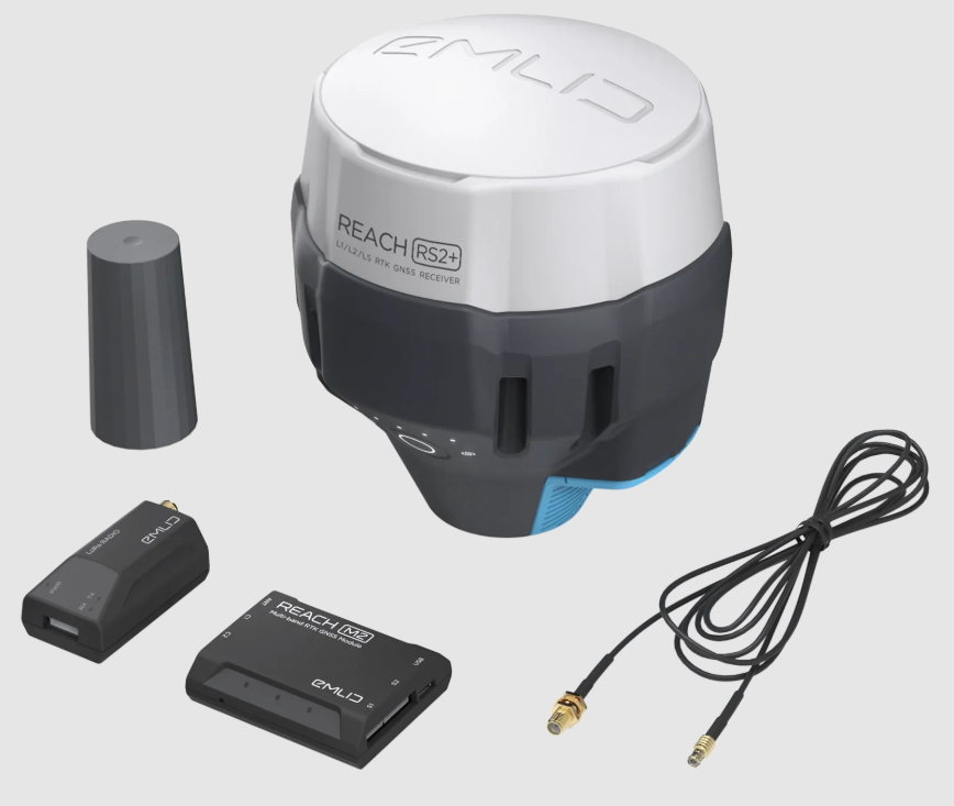
Contents from the Mapping Kit:
-
1 × Reach RS2+ - advanced RTK GNSS-base station
-
1 × Reach M2 - compact RTK GNSS-module for UAVs
-
1 × Multiband GNSS-antenna - for consistent and accurate signal reception
-
1 × SMA-antenna-adapter cable (0,5 m) - suitable for M+/M2
-
1 × Camera hot shoe adapter (optional) - sync with camera trigger
-
1 × Radioantenna - for LoRa-communication
-
1 × Carrying case with shoulder strap - protects your equipment on the go
-
1 × USB Type-C cable - for power/data
-
1 × MicroUSB cable
-
1 × JST-GH 6-pins to sweater cable - easy connection
-
1 × JST-GH 5-pins to sweater cable
The ideal mapping-solution for drone professionals who no compromise want on precision.