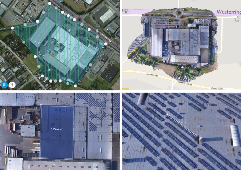
Bij werkzaamheden is het altijd nuttig om een As built plan te hebben. Wij kunnen de oude en de nieuwe situatie vastleggen met behulp van een drone en luchtfoto’s. Door middel van fotogrammetrie software kunnen er in dit As Built plan opmetingen gedaan worden. Deze metingen zijn nauwkeurig tot op 10cm en hebben minder dan 10% afwijking. Door gebruik van een RTK GPS kan dit tot op 2-3cm nauwkeurig.